

Zuko Komisa

South Africans can brace for a week of inclement weather as a significant cut-off low pressure system is poised to sweep across much of the country, bringing with it heavy rainfall, plummeting temperatures, and the risk of severe thunderstorms.
The South African Weather Service (SAWS) has issued warnings of widespread showers, potential flooding, damaging hail, and even snowfall in mountainous regions.
The weather system is predicted to make landfall over the western interior on Wednesday, 23 April 2025, before slowly tracking eastward and exiting the country by Saturday, 26 April 2025.
The SAWS cautions that the central and Eastern parts of South Africa are likely to experience scattered to widespread showers and thundershowers. Rainfall accumulations could exceed 50 mm in eastern regions, particularly on Wednesday and Thursday.
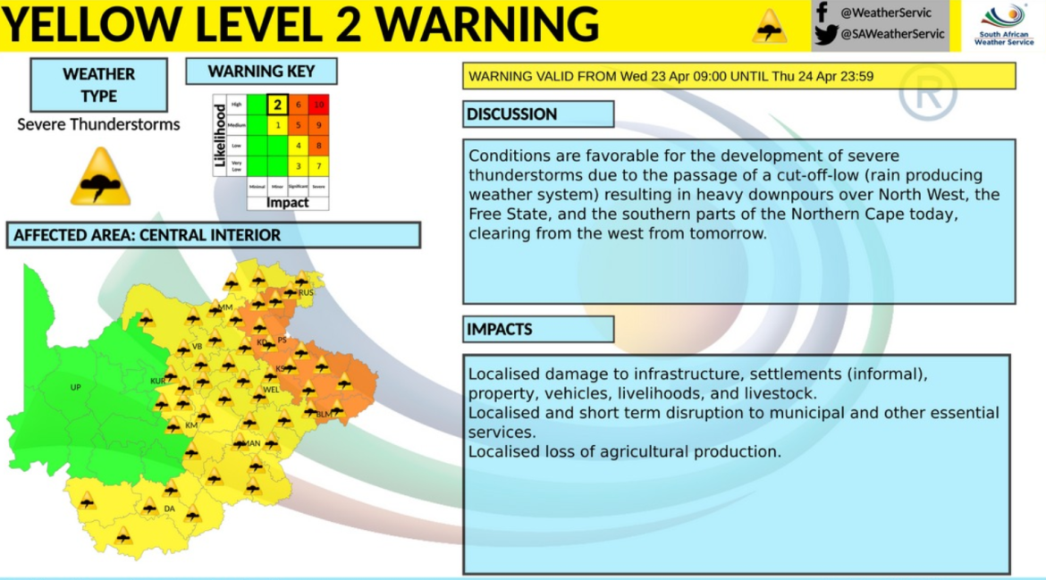
The weather service warns of possible flooding of roads and settlements, as well as the risk of damage to infrastructure, property, vehicles, livelihoods, and livestock. There is also a distinct possibility of damaging hail accompanying these thunderstorms.
Adding to the wintry conditions, snowfalls are expected over the high-lying Drakensberg mountains spanning Lesotho, KwaZulu-Natal, and the Eastern Cape throughout this period.
Point of View with Phemelo Motene spoke to Meteorologist and Weather Forecaster at the South African Weather Service, Lehlohonolo Thobela about the weather conditions.
![[WATCH PODCAST] Kabelo Mabalane teams up with The Arrows for infectious comeback track ahead of 10th studio album](https://www.kaya959.co.za/wp-content/uploads/2026/10/KAYA-959-THUMBNAILS-1170x658.png)

![[WATCH PODCAST] Kabelo Mabalane teams up with The Arrows for infectious comeback track ahead of 10th studio album](https://www.kaya959.co.za/wp-content/uploads/2026/10/KAYA-959-THUMBNAILS-100x100.png)